
- Quarrymans' Ways - 1.5 miles (2.5km)
- Abbotsbury and White Hill - 2.5 miles (4km)
- Ferrybridge to Weymouth - 2.5 miles (4km)
- Poole Quay to Whitecliff - 3 miles (4.8km)
- Portesham to Abbotsbury - 3.3 miles (5km)
- Burton Bradstock to West Bay - 4.6 miles (7.4km)
- Purbeck Way (Wareham, Corfe Castle and Swanage) - between 6 miles (10km) and 15 miles (25km)
- Dorchester and Thomas Hardy's Cottage - 7 miles (11km)
- Isle of Portland - 8.5 miles (13.7km)
- Hengistbury Head to Sandbanks - 10 miles (16km)
Quarrymans' Ways - 1.5 miles (2.5km)
Back to Top of ListThis is a short, circular trail starting in the hamlet of Acton providing a unique chance to see old quarries and imagine what the Isle of Purbeck must have been like 100 years ago.
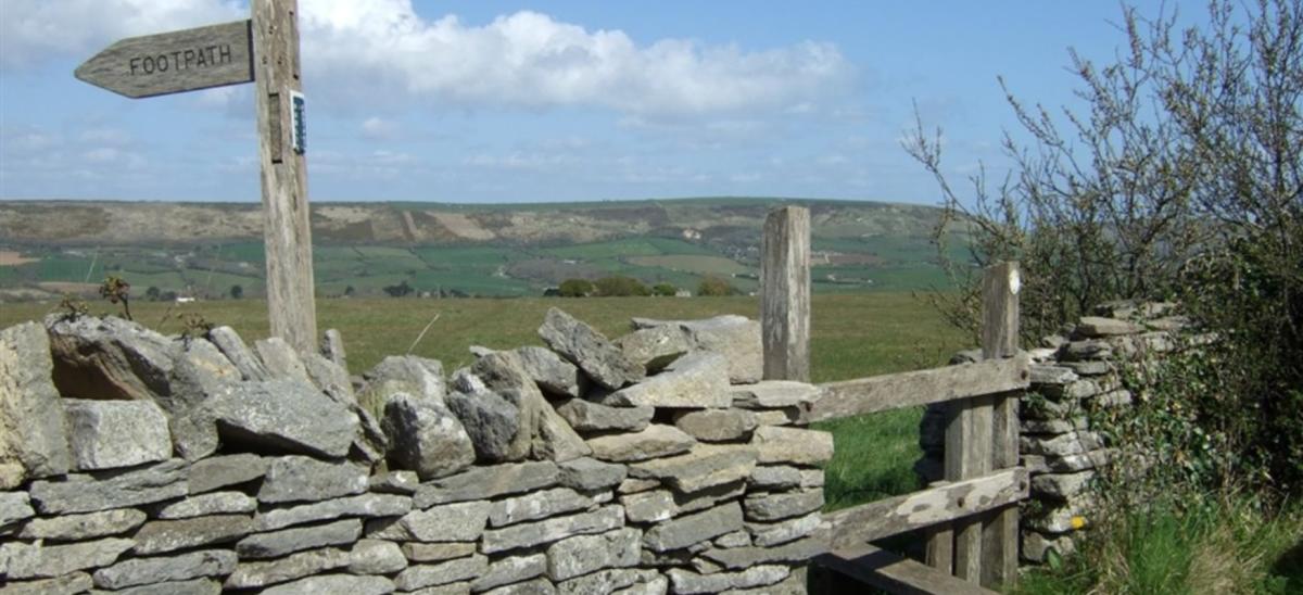
Burngate Purbeck Stone Centre is just a short walk away from the bus stop, so if it’s open they might be serving refreshments and the chance to see their stone sculptures and crafts.
Distance: 1.5 miles (2.5km) circular route.
Walking Time: 30 minutes to 1 hour.
Route Difficulty: Easy.
Bus information: The Purbeck Breezer 40 bus stops in Acton, get off the bus at the Acton Lane bus stop. This bus connects Poole to Swanage via Wareham and Corfe Castle.
Read more about the Quarrymans' Ways walking route.
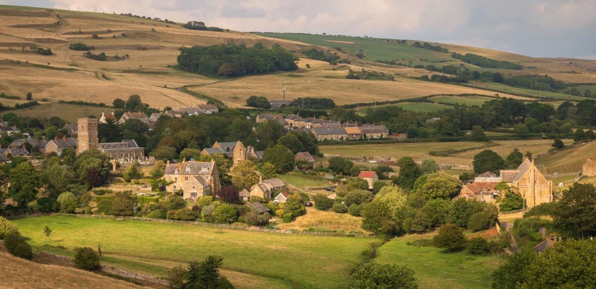
Abbotsbury and White Hill - 2.5 miles (4km)
Back to Top of ListThis short, circular walking route starts at the picturesque village of Abbotsbury. Along the way you’ll pass through ancient landscapes marked with strip lynchets (ancient field systems, commonly seen in this area) and the white chalk of White Hill, which is part of the South Dorset Ridgeway.
Abbotsbury village © Richard Rakauskas
Distance: 2.5 miles (4km) circular route.
Walking Time: 70 minutes.
Route Difficulty: Moderate.
Bus information: This route starts at the Ilchester Arms pub in Abbotsbury. Buses X53 and X52 stop here (the X52 is a summer bus service only). These buses connect Weymouth with Axminster via West Bay, Bridport and Lyme Regis.
Read more about the Abbotsbury and White Hill walking route.
Ferrybridge to Weymouth - 2.5 miles (4km)
Back to Top of ListThis walk starts at Ferrybridge, at one end of the causeway which joins Weymouth to the Isle of Portland. At the start of the route you’ll pass Smallmouth Bay and then join the Rodwell Trail towards Weymouth.
The Rodwell Trail follows a disused passenger railway line, but you can still see the old railway platforms along parts of the trail. Now, it is used by walkers, cyclists and mobility scooters as an easy, traffic free route.
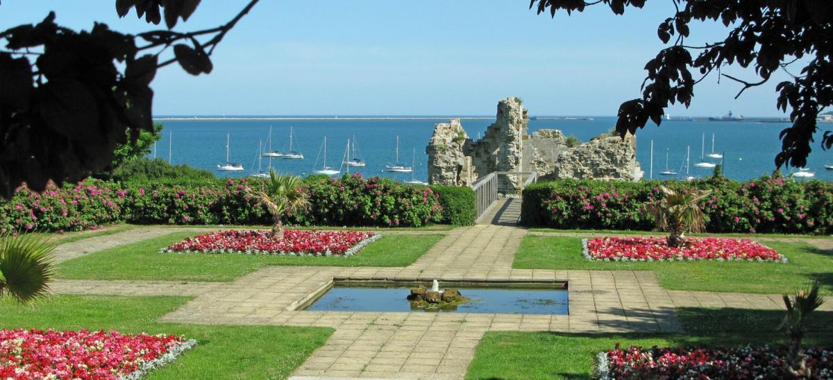
Sandsfoot Castle
Be sure to stop halfway along the route at Sandsfoot Castle. This small castle is free to visit and has fantastic views across to the Isle of Portland. There is also a café here, and large grassed areas perfect for picnics.
Distance: 2.5 miles (4km) one-way.
Walking Time: 90 minutes.
Route Difficulty: Easy.
Bus information: This walking route starts at the Ferrybridge bus stop. Travel by the number 1 or Portland Coaster bus from Weymouth town centre to this bus stop. The number 1 bus operates all year round. The Portland Coaster bus operates during the summer only.
Read more about the Ferrybridge to Weymouth walking route.
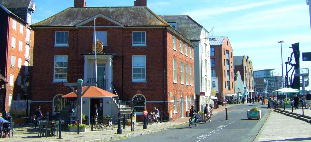
Poole Quay to Whitecliff - 3 miles (4.8km)
Back to Top of ListThis scenic, flat route starts at the Sea Music Sculpture on Poole Quay, which is a short walk away from where the Route One Bus will drop you off. There are wonderful, elevated views of the Quay and Harbour from the top deck of the sculpture.
Follow the flat, tarmac path alongside the Quay and into Harbourside Park. This is a linear route, so once you reach Turks Lane, turn back and retrace your steps to Poole Quay.
Distance: 3 miles (4.8km) in total.
Walking Time: 90 minutes.
Route Difficulty: Easy.
Bus information: Route One Bus connects Poole Bus Station and Poole Railway Station with Poole Quay.
Read more about the Poole Quay to Whitecliff route.
Portesham to Abbotsbury - 3.3 miles (5km)
Back to Top of ListThis walks travels between the two villages of Portesham and Abbotsbury. Walk through farmland before joining the South West Coast Path, passing the entrance to Abbotsbury Swannery along the way.
 © Abbotsbury Swannery
Distance: 3.3 miles (5km) one-way.
Walking Time: 90 minutes.
Route Difficulty: Moderate.
Bus information: The starting point is the Village Hall bus stop or Kings Arms bus stop in Portesham. Buses X53 and X52 stop here (the X52 is a summer bus service only). These buses connect Weymouth with Axminster via West Bay, Bridport and Lyme Regis. Catch the X52 or X53 from outside the Ilchester Arms pub in Abbotsbury back to Portesham.
Burton Bradstock to West Bay - 4.6 miles (7.4km)
Back to Top of ListWalk from the small village of Burton Bradstock to West Bay’s harbourside along an inland route.
Follow a ridge of 170 million year old Jurassic limestone from the River Bride to the River Brit. Look out for old quarries that provided stone to build the surrounding towns and villages, places where the legacy of an ancient tropical sea is transformed to create distinctive local character.
 The harbour at West Bay © Diana Jarvis
Distance: 4.6 miles (7.4km) one-way.
Walking Time: 2 hours.
Route Difficulty: Moderate.
Bus information: This route starts at the Hive Beach bus stop in Burton Bradstock. Buses X53 and X52 stop here (the X52 is a summer bus service only). These buses connect Weymouth with Axminster via West Bay, Bridport and Lyme Regis. You can catch the X53 or X52 bus from West Bay (outside The George pub) back to Burton Bradstock.
Read more about the Burton Bradstock to West Bay walking route.
Purbeck Way (Wareham, Corfe Castle and Swanage) - between 6 miles (10km) and 15 miles (25km)
Back to Top of ListThe Purbeck Way passes through some of the most varied and spectacular scenery in Britain. This is a signposted walking route which can be walked in either direction.
If you choose to start walking from Wareham, you will follow the banks of the River Frome and then continue through heathland, woodland and grassland for 6 miles (10km) until you reach Corfe Castle. You can then return to Wareham by bus or keep walking for another 9 miles (15km) until you reach England’s first natural World Heritage Site, the ‘Jurassic Coast’ at Ballard Down.
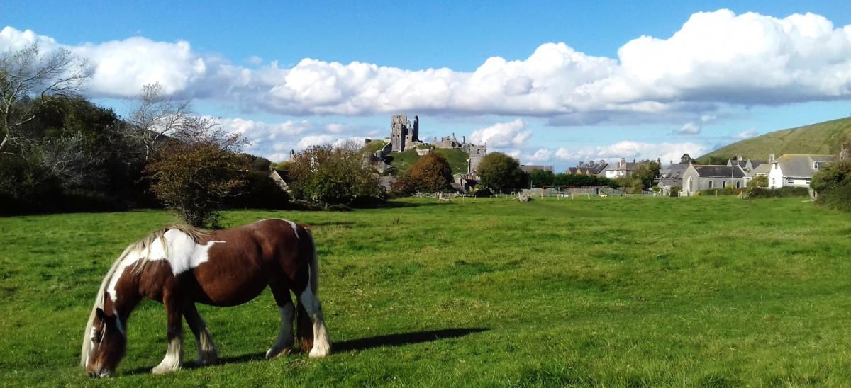
Corfe Castle village
Distance: 6 miles (10km) from Wareham to Corfe Castle one-way. 9 mile (15km) from Corfe Castle to Swanage one-way. 15 miles (25km) from Wareham to Swanage one-way.
Walking Time: 3 hours to 8 hours.
Route Difficulty: Easy (Wareham to Corfe Castle) to Moderate (Corfe Castle to Swanage).
Bus information: The number 40 Purbeck Breezer bus connects Wareham with Corfe Castle and Swanage. At Wareham, get off the bus at South Bridge bus stop. At Corfe Castle, the bus stops at the Village Centre (East Street). At Swanage, the bus stops at Swanage Bus/Railway Station. If you are walking between Corfe Castle and Swanage, you can return to your start point using the Swanage Railway heritage trains.
Read more about the Purbeck Way walking route.
Dorchester and Thomas Hardy's Cottage - 7 miles (11km)
Back to Top of ListStarting in the county town of Dorchester, follow this circular walking route to the cottage where the famous author Thomas Hardy was born. The cottage is located within Thorncombe Wood where there is a Thomas Hardy Visitor Centre and café.
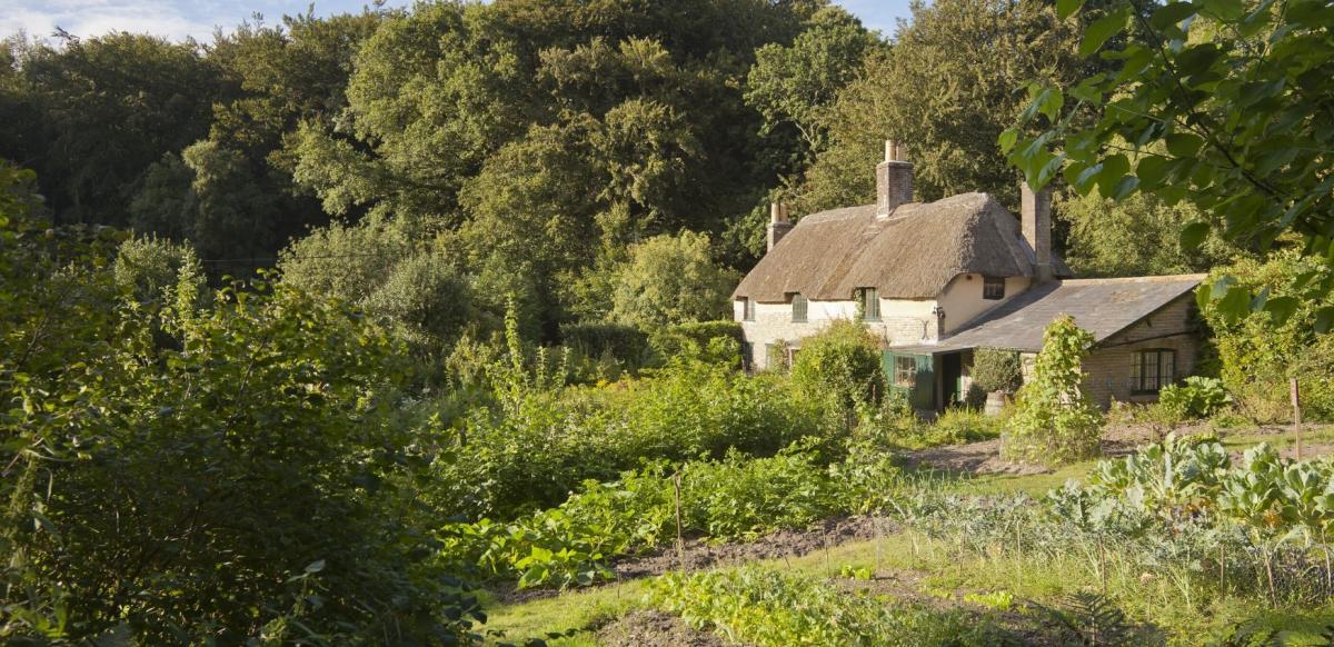
Hardy's Cottage © National Trust Images
The cottage is now owned by the National Trust and it is open to the public for part of the year, but you will need to book a ticket in advance if you wish to go inside.
Hardy used the Dorset countryside as the inspiration for his poems and novels. His fictional name for Dorchester was ‘Casterbridge’ and the area was known as ‘Wessex’.
Distance: 7 miles (11km).
Walking Time: 2 to 4 hours including stops.
Route Difficulty: Easy.
Bus information: The walking route starts at High West Street where there is a bus stop outside Dorset Museum (there is a café inside the Museum). Numerous buses stop here from other Dorset towns including Weymouth, Bridport and Blandford. Find out more on the Discover Dorchester website.
Read more about the Hardy's Cottage walking route.
Isle of Portland - 8.5 miles (13.7km)
Back to Top of ListThis walking route circumnavigates the majority of the Isle of Portland. Portland is unlike anywhere else in Dorset and is known for its rugged coastline and red and white stripped lighthouse. Along the way you’ll pass the High Angle Batteries, Rufus Castle, Church Ope Cove, Portland Bill lighthouse and Tout Quarry Sculpture Park.
 Church Ope Cove
Distance: 8.5 miles (13.7km) circular route.
Walking Time: 4 hours.
Route Difficulty: Moderate.
Bus information: This walking route starts at the Heights Hotel bus stop on Portland. If you’re staying in Weymouth or have travelled by train to Weymouth Railway Station, walk to the Kings Statue on the Esplanade and find the bus stop for the number 1 or Portland Coaster bus. The number 1 bus operates all year round. The Portland Coaster bus operates during the summer only.
Hengistbury Head to Sandbanks - 10 miles (16km)
Back to Top of ListThe promenade between Hengistbury Head in the east to Sandbanks in the west is great for taking a seafront walk next to award winning beaches.
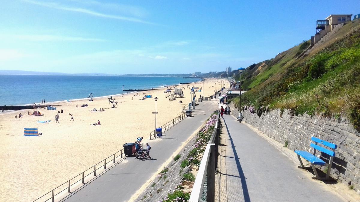
The whole length of the promenade is 10 miles (16km), but you can walk as little or as much as you want before returning to your start point. From the start point to Boscombe Pier is 2.6 miles one-way and another 1.5 miles to Bournemouth Pier. If you don’t want to walk back again, you can catch the number 33 bus from East Overcliff Drive, which is the road above the promenade between Boscombe and Bournemouth. During the summer, the Beach Breezer 70 bus stops at many locations close to the promenade.
Distance: 10 miles (16km) one-way but can be shortened.
Walking Time: 1 hour to 5 hours.
Route Difficulty: Easy.
Bus information: Bus number 33 and Beach Breezer 70 both stop near to Hengistbury Head, get off the bus at the Cellars Farm Road bus stop. Follow the road towards the sea and use one of the footpaths on the right to walk down onto the Promenade. Turn right and walk towards Southbourne, Boscombe, Bournemouth and Sandbanks. If you walk all the way to Sandbanks, you will need to catch the number 50 bus to Bournemouth town centre, then catch the number 33 or number 70 bus back to Hengistbury Head.
Read more about the Hengistbury Head to Sandbanks walking route.
